Somaliland livestock production
The dynamics of natural resources in Somaliland
Implications for livestock production
Agriculture is the most important sector of Somaliland’s economy. In 2012, the sector contributed more than 40% of Somaliland’s GDP—with the livestock sub-sector contributing 29.5%. Livestock production in the country is mainly extensive in pastoral systems that rely on fragile natural resources. The objective of this study was to investigate and document the current natural resources relevant to livestock production in Somaliland, identify the major drivers of land and resource use including landscape functions, and to identify pastoralists’ existing strategies to adapt to changes in land use in the country. Traditionally, pastoralists have governed water access and grazing in their lands through institutions, rules and regulations.
The study showed that increasingly there are multiple claims on natural resources and land in Somaliland and that these competing claims are being exacerbated by climate stress, in conjunction with other factors such as population growth and urbanization. Water points and water access are at the centre of these claims. However, these water points and the surrounding areas are increasingly settled, and often enclosed, by pastoralists who have lost their animals. Setters have also established enclosures for production of crops and fodder. This effectively blocks the transhumance routes and herders’ access to the water vital to their livelihoods, damaging livestock production and herders’ adaptive capacity. This is exacerbated by the practice of harvesting trees around the settlements to make charcoal, which further degrades community pastures. As such, there is increasing likelihood of conflict between pastoralists and settlers.
This report discusses two policy options designed to reduce land degradation and increase the adaptability to climate change: communal rangeland management, and land-use planning for pastoral corridors and areas. The development and effective implementation of either of these policies requires a strong participatory approach that involves pastoralists. This report also discusses how emerging new earth observation technologies could be a game changer in supporting the monitoring of these policies from the sky.
Introduction
Description of the Somaliland climate and natural resource base
Somaliland is located in the Horn of Africa, with an area of 137,600 km2 and a population of about 3.80 million people. It is estimated that approximately 11% of the population lives in rural areas, 34% is nomadic, 2% is internally displaced persons (IDPs) and the remainder (53%) reside in major towns (MoNP&D 2017). These towns include Hargeisa (with a population of about 500,000), Burao (>100,000), Borama (>80,000), and Laas Caanood (over 30,000). Somaliland faces a high population growth estimated at 4.3% per annum1. This growth is much higher in urban areas, where it reaches approximately 20% per year in Hargeisa (MoNP&D 2011).
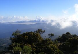
Somaliland’s environment consists of a variety of ecosystems, comparatively limited biodiversity and scarce water resources (Figure 1) (Monaci et al. 2007). The topography is characterized by three main landforms: (i) Piedmonts and the coastal plain (Guban) situated southward from the Red Sea with elevations ranging from seas level to 600 m; (ii) Hills and dissected mountains (Oogo) of rugged features and rising to more than 1,500 m; and, (iii) the plateau (Hawd) with large areas of undulating plains. There are three main climate zones in Somaliland: (i) desert; (ii) arid; and, (iii) semi-arid. The vegetation is characterized mostly by grass, shrubs and woodland. Perennial grasses such as Lasiurus scindicus and Panicum turgidum and scattered trees such as Balanites orbicularis, Acacia tortilis and Boscia minimiflora are the most predominant vegetation in the coastal zone of Somaliland, particularly in the western part. Juniperusprocera woodland is more present in the mountainous areas. In the plateaus, Acacia etbaica bushes and woodland as well as open grasslands or bans are common. In these areas pressure on grazing is intense. The Hawd is characterized by Commiphora woodland and bushes. The Nugaal valley largely supports sparse trees such as Acacia tortilis and shrubs (MoNP&D 2017).
Temperatures are generally high throughout the year, with the maximum being 36–38°C in the coastal areas (Basnyat 2007). Rainfall has bimodal distribution, with the first main rainy season, Gu, occurring between April and June and the second, Deyr, from August to November. The two dry seasons are Jilaal (December and March) and Hagaa (July and August). It is important to note that areas around Sheikh, Hargeisa, Borama and Erigavo towns receive the higher volumes of rainfall, an average of 400 mm per year, supporting limited crop production. The northern coastline is characterized by low rainfall amounting to less than 100 mm per year. The rest of Somaliland receives an annual rainfall ranging from 200 mm to 300 mm (Figure 2) (Paron and Vargas 2007).
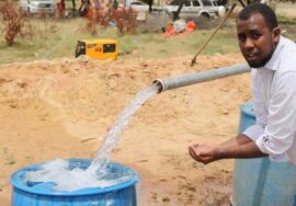
The low precipitation amounts have led to scarce water resources, and absence of permanent rivers and lakes. Groundwater (from dug wells, boreholes and springs) is the main source of water for the majority of the people. This water source is harnessed by the rural and urban population to meet domestic and livestock water needs as well as for small-scale irrigation. In 2012, according to FAO SWALIM (Petersen and Gadain 2012), there were a total of 1,037 water sources of which more than half were shallow wells. Dams were restricted only to the region west and south of Hargeisa, while springs were found in the mountainous regions, particularly in Awdal, between Hargeisa and Berbera and around Erigavo regional towns.
The major land use is pastoralism with agro-pastoralist zones in the southwest where most rain-fed cropland is found and the northeast where irrigated cropland is found. Cattle are mostly found in the west, the wetter part of Somaliland, camels in the driest and goat and sheep elsewhere.
Somaliland has different types of soils (see Figure 4 for a simplified soil map). The soils are Leptosol, Cambisol, Regosols and Solonchaks2. Overall, the soils have poor structure with high permeability, low moisture retention capability and inadequate internal drainage. Though the nature of these dryland soils makes them of poor quality, the clearing of vegetation for farming purposes, cutting trees for charcoal production and overgrazing have magnified their deficiencies. The progressive decline in soil quality (fertility) has impacted on the productivity of both farming and grazing lands.
Historical review of land use
A review of the history of land use and land-use planning in Somaliland reveals five different phases: the pre-colonial time (before 1887), the colonial time (1887–1960), civilian rule of government after independence (1960–1969), revolutionary military socialist regime (1969–1990) and the collapse of the revolutionary regime (after 1990). Each of these periods have had different policies and land-use planning processes or influences resulting in different land and resource utilization approaches (Venema et al. 2009).
In the pre-colonial time a set of customary norms (known as Xeer) provided the rules of interaction among members of a clan and other neighbouring groups. They guided access to and use of pasture, water and other natural resources, and every member of a clan had the right of access to the rangelands and water resources within the territory inhabited by the clan. Whereas the rangelands themselves were managed communally, private property rights were assumed for any infrastructure built on the rangelands. This property fell under Islamic law and could be inherited under those conditions. In wetter areas and enclosures for cropping, every household within the community was designated a plot for cultivation. Land in urban areas was considered privately owned. To a certain extent, this customary law is still applied today (Venema et al. 2009).
During the British colonial rule, much common land including in the pastoral areas was privatized, individualized and then registered, with title deeds issued for agricultural land covering a 50-year lease period. Other land uses were defined vis-à-vis grazing reserve—which aimed at increasing the availability of fodder in the dry period; forest reserve; and public water points. This rule favoured settlement of pastoralists (Venema et al. 2009).
From 1960–69 under the civilian rule, new land rights gave all Somali the right to use and live in any location.
However, while free grazing in rangelands was maintained, other grazing areas were privatized. In the revolutionary period, a socialistic land tenure regime was adopted, stipulating that all land belongs to the state, all the infrastructure on land was nationalized and any customary agreements between clans was declared invalid. Despite the new rules, the traditional land rights of clans were de facto maintained. The collapse of the Somali central government in 1991 led to the breakdown of all formal institutional and social structures, leading to an increase in illegal appropriation of land and water resources (Venema et al. 2009). To a certain extent, the old traditional clan-based customary law is still respected on communal land. Currently the Somaliland government is developing a new land tenure law, about which no one was willing to share details about because it is a sensitive topic.
Emerging issues that necessitated this study
Agriculture is the most important sector for Somaliland’s economy. In 2012, the sector contributed to more than 40% of the GDP—with the livestock sub-sector contributing 29.5%, crops and forestry 13.4%, and fisheries 0.2% (MoP&ND 2017). The sector is also a major employer, with livestock production and related activities employing around 27% of women and 20% of men. Most of the livestock production has traditionally been done under nomadic pastoralism. However, in the recent past, there has been an increasing shift towards adoption of agro-pastoralism at the expense of nomadic pastoralism in more regions of Somaliland. Agro-pastoralism involves the integration of limited crop cultivation and pastoral livestock production. It has been observed that the agro-pastoral production system has in one way or another allowed some livestock keepers to improve household food security by generating household food and income from both crops and livestock, thus minimizing the increasing risk of relying solely on pastoralism (MoNP&D 2017). However, ongoing drought challenges this investment in crop growing.
The current Somaliland National Development Plan (2017–2022) states that the evolving shift away from a pastoral livelihood system is driven by a number of factors. First, the country has been going through an intense process of population growth in urban areas, mainly driven by rural to urban migration. At the moment, the urban population already accounts for almost half of the total population.
Second, more frequent and severe climate hazards, especially droughts (Petersen and Gadain 2016), are challenging pastoral livelihoods sometimes with destitute pastoralists ‘dropping out’ of production moving to urban centres and/or alternative livelihood practices. The climate hazards have also contributed to increased soil degradation and erosion, progressive reduction in rainfall and higher temperatures that have not only intensified the negative impacts on natural resources but also caused additional changes that include altering the livestock mating calendar (Hartmann and Sugulle 2009).
It is estimated that about 30% of Somaliland’s land is severely degraded (MoNP&D 2017). The most common types of degradation include loss of vegetation cover, soil erosion3 and deforestation4. The vegetation types that have been highly exposed to land degradation include grass, forbs, sparse shrubs, and short trees, which are the prime sources of feed for livestock. The loss of these vegetation types has been attributed to livestock grazing and unregulated agricultural activities in the rangelands. The increase in agricultural activities has been associated with increasing land enclosures, all of which have affected the traditional livestock grazing patterns in some areas and led to the concentration of livestock in others. Besides, the proliferation of Berkheds (traditional underground water reservoirs) has also increased livestock and population concentration in certain areas where the surrounding vegetation has been exposed to further deterioration. Furthermore, the loss of native vegetation, has been accompanied by proliferation of invasive plant species such as Parthenium weeds (Keligii noole), Prosopis (Garanwaa) and Cactus (Tiintiin) all which have high seed production capacity and adapt easily to a wide range of climatic and soil conditions. Though livestock will for example eat Prosopis pods, they are generally unconsidered unsuitable for livestock particularly in their raw state and the loss of grazing land to these invasive species outweighs any benefit (Omuto et al. 2009; Vargas et al. 2009).
These changes have contributed to the increase in conflicts over land use. Understanding the dynamics that drive land use change is important for supporting policymakers’ development of a land use policy that contributes to the reduction of land conflicts. Such policies can support the emergence of a multifunctional landscape5 that accommodates the pastoral production system that needs to adapt to new climatic conditions as well as the new emerging claims from settlers (Leemans and de Groot 2003). The objective of this study was to investigate and document the current natural resources relevant to livestock production in Somaliland, identify the major drivers of land use change at landscape scale that influence landscape functions, and identify pastoralists’ existing strategies to adapt to these changes. It is envisaged that the information generated will inform policy formulation that will accommodate these new and evolving land uses by combining, where possible, different landscape functions.
Discussion
Two immediate reflections result from this research. First, given the landscape dynamics identified in this research, what are possible interventions to improve the status of natural resources and support the transition in adapting to climate change? Second, this report has made use of freely available high-resolution satellite images in a very simple way. This technology is about to bring new products that are both opportunities and threats in the Somaliland context. Therefore, this discussion has two separate sections, the first putting the identified dynamics into context and the second relating to issues of land-use planning.
Implications of the landscape dynamics
As these results show, the pastoralist lifestyle is under strain, and it should be noted that this data was collected prior to the acute drought and famine of 2017. Not only is climate change reducing the availability of biomass needed to sustain the livestock sector, human behaviour also reinforces the negative trends in biomass availability.
This report identified several of these reinforcing behaviours that further increase pressure on land and the pastoralist community. First, in rangelands, the increased number of animals leads to decreased biomass to support the livestock sector. This can be partially addressed by managing the rangelands and/or the animals. Second, the increasing number of enclosures around settlements and water points is blocking traditional pastoral routes heightening the pressure on the pastoralists. In order to avoid conflicts, land-use planning needs to be developed making use of the synergies between the different and sometimes conflicting landscape functions so that a multifunctional landscape can emerge.
Rangeland management
At the core of self-enforcing landscape dynamics is the increased number of livestock making use of rangelands which are in turn being degraded due to the significant pressure of these animals. Increasing the biomass production of degraded rangelands is to a certain extent possible through the sustainable management of these areas. Firstly, managing access to the rangelands during different seasons avoids overgrazing and allows for resting during the grass-growing season. Secondly, soil and water conservation interventions when implemented correctly can restore degraded land as they improve water holding capacity and in the long-term will provide more biomass. The soil and water conservation interventions can range from tree planting, to terraces, soil bunds, trenches or half-moon constructs. The suitability of these interventions is very context specific, and the benefits of these interventions are generally only seen when different interventions are simultaneously implemented in a watershed (Prager and Pfeifer 2015). The territorial diagnostic report of the land resources of Somaliland (Ullah 2016) acknowledges this and suggests that the methodology of the Land Degradation Assessment in Drylands Programme/World Overview of Conservation Approaches and Technologies should be used. It also points to a certain number of trust funds that could support the addressing of this resource degradation.
Land-use planning: Towards transhumance corridors and parks
Competing claims on land coming from urbanization and settlements driven by population growth and climate change are putting the pastoral production system under pressure and are going to intensify in the upcoming years. If these competing claims are not addressed in a meaningful way with the respective stakeholders, conflicts will emerge.
Conflicts between sedentary agriculturalists and pastoralists are increasingly an issue at the fringe of drylands across Africa. To address these potential conflicts, West African countries have been working together to develop a pastoral plan that consists of fixed pastoral routes marked on the ground with paint and creation of so called pastoral parks, common grazing lands that are declared public access areas. In these parks no cropping can take place. These often have infrastructure such as purpose-built water points and vaccination areas (Alidou 2016; Ayantunde et al. 2014). This is a significant undertaking as every route and park needs to be negotiated with local stakeholders. In some places, for example the Bama commune in Burkina Faso, cropland needed to be expropriated in order to ensure that the 30 m wide route can take pastoralists through the cropping area (personal communication), which required negotiations at all levels including national and international (GRAF 2014). Many routes are now marked and in use.
Somaliland could develop a similar plan to make sure that pastoral routes are kept open and at the same time allowing for land enclosures for those who have decided to settle. But the development of such a plan is likely to be a huge undertaking, as corridors through emerging settlements have to be planned in a participatory manner, engaging both pastoralists and settlers. However, because enclosures are currently illegal, no expropriation of land is needed, so it should not be difficult to enforce such corridors.
Combining top-down and bottom up approaches
Managing rangelands sustainably and the people who rely on them is very complex and cannot be successful if top- down and bottom-up approaches are not combined and used complementarily. Top-down approaches should set the ‘rules of the game’, clarify what the right of use of the land is through guiding principles or a general land-use plan. An example of how this can be done is the Burkina Faso case, where there is a top-down agreement that pastoralists have the right to cross the areas and there exists the legal environment to set up these routes.
However, how the local governance of the rangeland, i.e. how the rules are implemented on the ground, such as which areas are closed, who gets access at what time and on what conditions, can only be enforced through bottom- up approaches that engage all stakeholders on the ground. Indeed, participatory processes enable taking the local contexts into account and foster sustainable agreements among the different stakeholders that will allow enforcement of the agreed rules. Developing a sustainable participatory rangeland management process is not a simple enterprise. Flintan and Cullis (2010) propose a guideline with 12 steps on how to implement a successful participatory rangeland management process that encompasses three major stages, namely, (i) investigating the participatory rangeland management; (ii) negotiating the participatory rangeland management and (iii) implementing the participatory rangeland management. In the Burkina Faso example, the pastoral routes were developed through a participatory process that engaged all stakeholder on the ground. Though overall the transhumance routes are a success, there are locations where different stakeholders are still in conflict.
Conclusions
This report describes the multiple and competing claims on land in Somaliland which have been exacerbated by climate stress in conjunction with other factors such as population growth, urbanization and the lack of natural resource management systems. The multiple claims are mainly emerging in proximity to water sources. Customarily, pastoralists rely on traditional water points and on the surroundings for feed and fodder for their animals. The pressure on natural resources has increased due to a lack of land-use policy leading to the absence of guiding principles on how to address these multiple claims, and the lack of participatory rangeland management leading to conflicts between pastoralists and other land users.
Increasingly pastoralists who have lost their animals are choosing to settle in rangelands. This blocks the transhumance routes and herders’ access to water vital to their livelihoods. Settlers’ intensive production of crops and fodders in enclosures also damages the herders’ adaptive capacity. This is exacerbated by the practice of harvesting trees around the settlements to make charcoal, which further degrades communal pastures. As such, there is increasing potential for conflict between pastoralists and settlers. This report has identified the landscape dynamics that are influencing the landscape functions that support the livelihoods of both pastoralists and settlers. However, it is important to identify mechanisms for a more equitable distribution of benefits, an often overlooked element of ecosystem service analyses (Lakerveld et al. 2015). The report also reviewed upcoming digital products that might act as rangeland management tools. Understanding how livestock-related ecosystem service functions interact with provisioning functions (crop production), regulating functions (erosion control) and cultural functions (Somali pastoral lifestyle and identity) is essential in better exploring which of these functions can be combined in a multifunctional landscape. This information will be important for the development of policy to improve and implement land management strategies in the face of climate change.