Somaliland Water Infrastructure
WATER INFRASTRUCTURE DEVELOPMENT FOR RESILIENCE IN SOMALILAND PROGRAM
1. INTRODUCTION
Somaliland is located in the Horn of Africa, with an area of 137,600 km2 with a population of about 6.85 million according to the Ministry of National Planning and Development (Somaliland in Figures, 2011). Somaliland is a majorly water scarce country with no perennial river flow making groundwater is the main source of water for the majority of the people in Somaliland.
In Somaliland estimates say that 55% of Somaliland communities live in rural areas but less than 20% have access to improved water supplies and nearly 88% lack access to universal sanitation. This must be addressed and this is complicated significantly by: (i) Continued conflict, (ii) The low rainfall and very complex hydrogeology of the country, (iii) The centrality of pastoralist livelihoods to the economy, (iv) Weak or absent local government institutions.
The program involves rehabilitation of existing earth dams and construction of boreholes and additional dams in unserved areas. According to the Bank’s ESAP, the project is classified as Category 2 mainly because most impacts are site specific and have no significant and irreversible detrimental effect. According to the Bank’s Climate Safeguards System, the program is classified as Category II, requiring the implementation of adaptation measures to increase the resilience of communities and the water infrastructure to be rehabilitated and constructed to withstand the impacts of climate change. The program details are at preliminary stage and the detailed designs shall be developed during project implementation. For these reasons, the type of Environmental Assessment tool for at this stage is the development of the Environmental and Social Management Framework (ESMF).
2. DESCRIPTION OF PROGRAMME OPERATIONS
The proposed Water Infrastructure Development for Resilience program to be financed by the Bank has three main components;
- Support for construction and rehabilitation of Water and Sanitation infrastructure for resilience and stability,
- Capacity Building Component for the Ministry of Water Resources in Somaliland,
- Project
To date, in Somaliland, the exact locations of the project sites are not known (only Regions identified) (Awdal, Maroodi Jeex, Togdheer and Sool
1. ENVIRONMENTAL AND SOCIAL BASELINE INFORMATION
Somaliland is located in the Horn of Africa, with an area of 137,600 km2 and a biophysical environment consisting of a variety of ecosystems, limited biodiversity and water resources. The altitude ranges from 2,100 meters above sea level at the highest peak, to sea level. A large portion of the country consists of high plateaus and mountains but has no rivers or lakes.
Climate: The Somali climate is hot, arid to semi-arid. There are two wet seasons (Gu April to June, and Deyr October to November) with approximately 500 mm rainfall annually in the northern highlands, 50-150mm along coast, and 300-500 mm in the southwest. With the impact of climate change extreme weather patterns such as droughts and floods (see also natural disasters) are likely to increase in frequency and magnitude
The Gu’ (Spring) rainy season – late March to end of May followed by warm and relatively dry summer and rainy autumn that ends though the end of September in far West but ending through November in the East and dry season, which starts in December and ends in mid-March with hardly any rains.
According to FAO-SWALIM, 2012 a total of 1,037 water sources are found in Somaliland (see figure below). More than half of the water sources are shallow wells. Dams are restricted basically to the region west and south of Hargeisa, while springs are found in the mountainous regions, particularly in Awdal, between Hargeisa and Berbera and around Erigavo.
Flora: The vegetation in Somaliland is predominantly dry deciduous bushland and thicket dominated by species of Acacia thorn trees, commiphora, aloes, baobab, and candelabra trees are native to the semiarid regions, with semi-desert grasslands and deciduous shrub land in the western parts neighboring Ethiopia. Trees that provide frankincense and myrrh are native to the region as well. Mangrove trees are found in the western part of Somaliland namely from Zeila to Lowyacada along the Red Sea coast. Kapok, and papaya grow along the rivers. Coconut, dune palm, pine, juniper, cactus, and flowering trees such as the flamboyant were imported and have become widespread in populated areas.
Fauna: Along with its large livestock herd, Somalia has one of the most abundant and varied stocks of wildlife in Africa. Animal life includes elephants, lions, wildcats, giraffes, zebras, hyenas, hippopotamus, waterbucks, gazelles and other mammals, although many of them are on the verge of extinction or are already extinct. A large variety of birds inhabits the different geographical zones, among these several species endemic to the Somali Region, e.g. Somali Pigeon (Columba oliviae), Somali Thrush (Turdus ludoviciae) and Warsangli Linnet (Carduelis johannis). For whole Somalia a total of 171 species of mammals, 655 species of birds, and over 3,000 species of plants have been reported.
Environmental Degradation: According to Ibrahim, M.O. (2010), fauna and flora in Somaliland is affected by environmental degradation due to several factors such as: (i) clearing of vegetation and deforestation (average deforestation rate of 0.97% per annum); (ii) illegal charcoal production, trade and export; (iii) over-fishing and illegal fishing by foreign companies in coastal waters; (iv) indiscriminate shooting and hunting of wildlife; (v) uncontrolled over- grazing by livestock; (vi) Erosion and desertification. No official natural reserve or national park has been established in Somaliland so far.
Geomorphology: Somaliland can be divided into three major physiographic provinces: (i) The coastal belt and sloping plain; (ii) The mountainous zone incised by numerous toggas (rivers);
(iii) The plateaus and valleys which include the large undulated Hawd and Sool plateaus and the Nugal and Darror valleys. The highest elevations occur in the Golis Mountains near the Gulf of Aden. Coastal belt and plateaus have mainly an undulating topography.
Geology: The following major geological units can be distinguished in Somaliland: (i) Precambrian / early Cambrian basement complex: Volcanic and metamorphic rocks; (ii) Jurassic: Limestone, shale and sandstone; (iii) Cretaceous: Nubian sandstones (sandstones and limestones); (iv) Tertiary (Eocene): Limestone, evaporitic rocks (Auradu Fm., Taleex Fm., Karkar Fm.); (v) Tertiary (Oligocene to Miocene): Thick series of sedimentary rocks; (vi) Pleistocene to Recent: Basaltic rocks.
An isolated uplifted Neoproterozoic and early Cambrian complex occurs in western Somaliland paralleling the Gulf of Aden. The outcropping volcanic and metamorphic rocks are part of an early Paleozoic fold belt. Clastic and marine Jurassic sediments overlie the Basement complex. Cretaceous to Tertiary sediments with clastic sequences, limestones, evaporites and marine successions cover large parts of Somaliland. Small areas with young basaltic to liparitic volcanics are exposed close to Djibouti and in the Gulf of Aden area.
Land Use: The main land use in Somaliland is extensive grazing (pastoralism). Other land uses include rainfed agriculture practiced in the higher lying areas (plateau) of maroodi Jeex, Gabiley and Awdal regions in combination with pastoralism and wood collection Most of the cultivated crops are rainfed. Minimal irrigated agriculture especially for orchards along alluvial plains is also practiced mainly fruit trees such as citrus, guava, papaya, mango and vegetables. Water for supplemental irrigating of the crops is often obtained from wells, dams, and rivers. The eastern part of the country (Togdheer, Sool, Sanaag) is almost exclusively relying on livestock raising.
Socio-Economic Environment: The population of Somaliland in 2009 was estimated at 3.85 million according to the Ministry of National Planning and Development (Somaliland in Figures, 2011). About 55% of the people are nomadic pastoralists and 45% are urban and rural dwellers. Somaliland is predominantly a nomadic pastoral community and traditionally the major livelihood is livestock husbandry, which is the main source of food and income for 70% of the population including rural pastoral and urban communities. Crop production ranks second to livestock.
There are three main sources of revenue in Somaliland today: livestock, agriculture and remittance from the diaspora. Livestock is the backbone of the Somaliland region’s economy. Sheep, camel and cattle are shipped from the Berbera port and sent to Gulf Arab countries, such as Saudi Arabia. Less than 10% of land area is estimated to be is suitable for permanent agriculture. It is mainly found in the northwest regions, where high rainfall and fertile soils are both common. The major crops include maize, sugarcane, sorghum millet, and cotton. Wood collection for charcoal production is also very frequent and occurs almost in all Somaliland. Charcoal production is for both local household consumption and income generation through sales in the local markets and for export outside Somaliland.
Lack of access as a result of poor infrastructure, particularly roads, is inhibiting socio-economic development in the region. Access to health and education in Somaliland is generally limited. Somaliland is facing rapid urbanization, which is creating another vulnerable group – the urban poor. This group includes destitute pastoralists, economic migrants and people who are unable to make ends meet through lack of livelihood opportunities. Private sector business remains relatively limited so there are few employment opportunities.
Internally Displaced Persons (IDPs) and returnees occupy the major towns. It is estimated that up to 100,000 IDPs are languishing in IDP settlements in the major towns of Somaliland with contaminated water and no sanitation facilities, lack of access to basic social services, rampant disease and regular outbreaks of fire/arson. However, there is an active inter-agency IDP working group consisting of UN agencies, NGOs and local partners who are providing assistance to the Somaliland authorities on the provision of humanitarian assistance to IDPs, as well looking at the implementation of longer term responses which focus on IDP reintegration.
Temperature: The mean air temperatures are generally high, in the range of about 25oC to more than 35oC in the northern coastal regions (e.g. Berbera and Boosaaso) while it is cooler in the north-western mountain region (e.g. Shiekh) where it varies from about 15oC to about 23oC. In the inland areas of the Darror and Nugal basins, it varies between 22oC and about 33oC. The mean temperature is highest from June to August in the Gulf of Aden basin areas whereas the peak temperature occurs from May to September in the inland areas.
Potential Evapotranspiration: The annual Potential Evapotranspiration (PET) exceeds 2,000 mm in the Somaliland and Puntland, and is even as high as 3,000 mm in the Gulf of Aden. In most locations, PET exceeds rainfall in all months of the year. Except in a few locations in the extreme northwest regions, even 0.5 PET exceeds rainfall in all months, giving zero values for the longest vegetation growing period in most of the areas. This is why most areas in the northern basins are not suitable for agriculture (Basnyat, 2007).
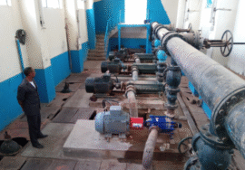
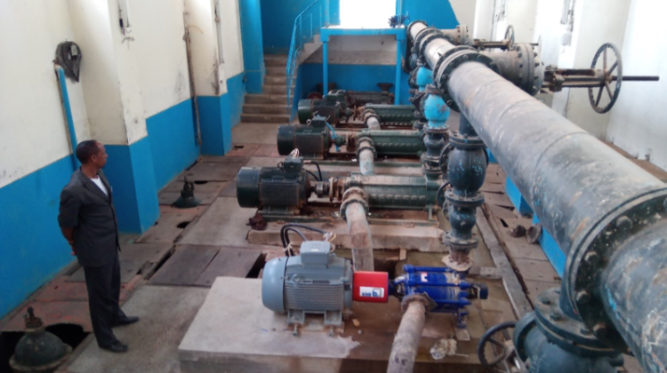
Water Resources: Water resources are generally scarce in Somaliland and there is no river with perennial flows in Somaliland. Groundwater is the main source of water for the majority of the people in Somaliland to meet their water needs, groundwater from dug wells, bore holes and springs are the primary sources of water for the population in the most of the country. Groundwater is harnessed by the rural and urban population to meet domestic and livestock water needs as well as for small scale irrigation.